Homeowner Resources


Tools
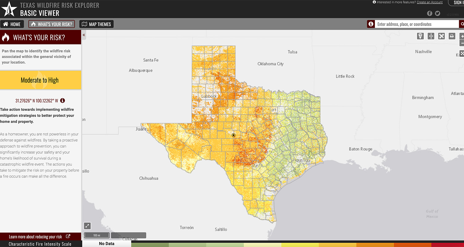
Texas Wildfire Risk Explorer
The Texas Wildfire Risk Explorer (known as the “Risk Explorer”) is the primary mechanism for Texas A&M Forest Service to deploy wildfire risk information and create awareness about wildfire issues across the state. This application is tailored to support specific workflow and information requirements for the public, local community groups, private landowners, government officials, hazard-mitigation planners, and wildland fire managers. The application also provides the baseline information needed to support mitigation and prevention efforts across the state.
The Texas Wildfire Risk Explorer data layers and information include: wildfire threat, wildland urban interface, surface fuels, historic wildfire ignitions, fire behavior, and much more.
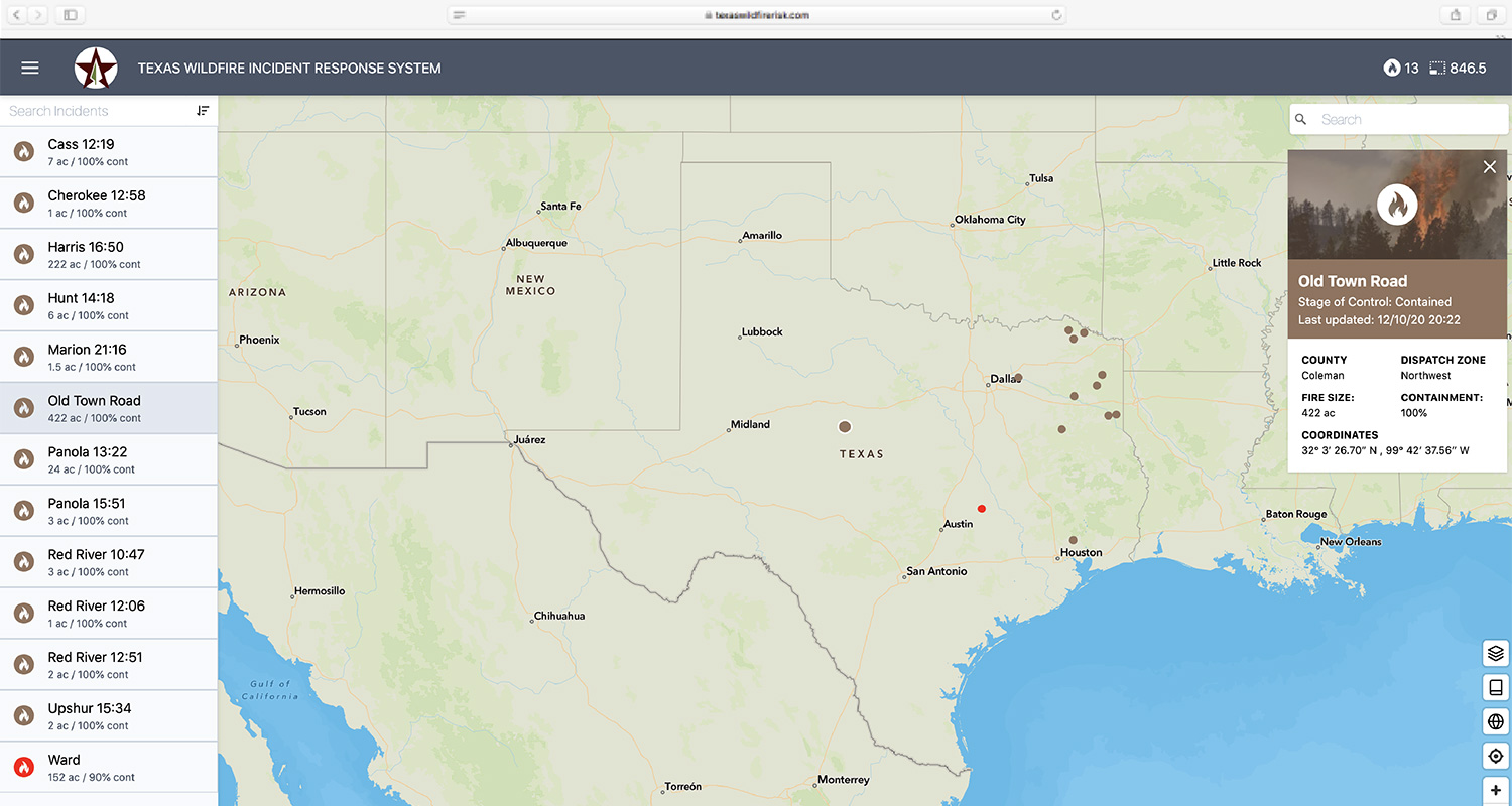
Texas Wildfire Viewer
The Texas Wildfire Viewer provides current information on Texas A&M Forest Service’s ongoing wildfires, including those that have been put out today. Wildfire incidents that are closed are not shown.
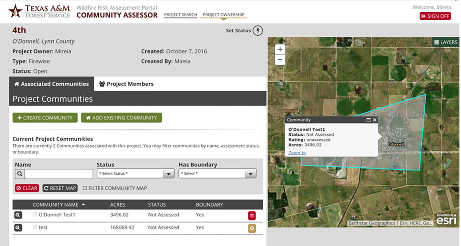
Community Assessor
The Community Assessor is a web and mobile suite that was developed to map and assess communities in the wildland urban interface. The main purpose of these assessments is to support projects for Community Wildfire Protection Plans and recognized Firewise USA® sites.
About Us
The Texas Wildfire Risk Assessment Portal (TxWRAP) is a free, easy-to-use website with information, data and resources to help homeowners and communities understand, identify and reduce their wildfire risk.
Wildfires continue to threaten people and property across Texas. As the state’s population grows, our communities are rapidly expanding into the wildland urban interface. Increasing effects of long-term drought and increased fuel loading conditions across the state present major concerns for communities in these areas. Fire has long since been an important part of our ecosystem and adapting our communities to live with fire is imperative as we continue to expand into wildland areas.
Our goal is to empower homeowners and communities to take action in reducing their vulnerability to wildfire by giving them the necessary tools to identify and understand their risk.

What's New In TXWrap
Key Enhancements of the Texas Wildfire Risk Assessment (TWRA) and TxWRAP Update:
Advanced Weather Modeling:
Enhanced from four basic percentile weather categories to 216 unique scenarios, this system incorporates variations across nine wind speeds, eight wind directions, and three moisture content levels. The resulting gridded weather conditions provide a more comprehensive dataset, improving the accuracy and range of wildfire modeling.
High-Resolution Data:
All wildfire hazard data are provided at a fine 10-meter resolution, generated from custom fuel mapping for Texas using high-resolution satellite imagery.
Updated Vegetation and Fuel Data:
Incorporates current vegetation conditions and recent disturbances, such as wildfires, prescribed burns, and fuel treatment activities, for more accurate wildfire hazard assessment.
Enhanced Data Layers:
Utilizes the latest advancements in wildfire hazard modeling to create new, high-resolution data layers that are nine times finer than previous TWRA layers.
Ember Modeling:
Identifies areas prone to ember production and locations likely to be impacted by lofted embers.
Fire Behavior Analysis:
Provides fire behavior outputs under both "characteristic" fire season conditions and "average worst" scenarios. The ‘average worst’ reflects fire behavior under the most extreme 5% of weather conditions.
Updated Housing Unit Maps:
Incorporates improved building footprint datasets and recent U.S. Census data.
Redesigned Project Area Report:
Features summaries for 25 data layers, enhancing its utility for wildfire hazard mitigation and planning.